MORE NEWS: AFRL leader: ‘We’re not moving fast enough’
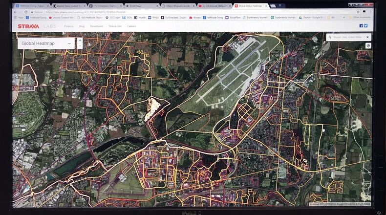
The spots included places in Afghanistan, Syria, Yemen and Africa, and all in areas or bases where U.S. troops congregate, the newspaper reported. The Post reported the interactive heat map is not live, but shows activity between 2015 and September 2017.
Department of Defense personnel engage in yearly training that recommends service members limit public profiles on the internet, Maj. Audricia M. Harris, a Pentagon spokeswoman, said in an email Monday to the Dayton Daily News. She added additional operational security requirements give guidance to U.S. troops around the world.
“Recent data releases emphasize the need for situational awareness when members of the military share personal information,” Harris said in the email. The Department of Defense “takes matters like these very seriously and is reviewing the situation to determine if any additional training or guidance is required, and if any additional policy must be developed to ensure the continued safety of DoD personnel at home and abroad.”
MORE NEWS: Wright Patt centrifuge operations delayed until March
A viewer of the global heat map can search by location. The map shows trails of light throughout the Miami Valley, including Wright-Patterson Air Force Base. The installation hosts the Air Force Marathon, a series of races that can draw as many as 15,000 runners from all 50 states and several countries, from Asia to Europe.
A message was sent to Strava, a GPS tracking company, for comment Monday.
Last summer, the company posted on its blog instructions on how users can control the privacy of their location and opt out of sharing data with the Global Heat Map.
About the Author
