DOWNLOAD OUR FREE MOBILE APPS FOR LATEST BREAKING NEWS
By noon, nearly 3 inches of rain had accumulated in parts of Warren County, while sections of Montgomery County received over 2 inches and about an inch fell in regions of Greene County, Storm Center 7 Meteorologist Brett Collar said. Rain began falling in the area at around 4 a.m., but by noon the initial storms had moved east.
Similar conditions will persist Thursday, according to Storm Center 7 Meteorologist McCall Vrydaghs. The forecast calls for more scattered showers and storms, as “the same threat for severe weather will remain, with damaging winds and flooding a concern.”
RELATED: Flood advisories remain for some, showers and storms tonight
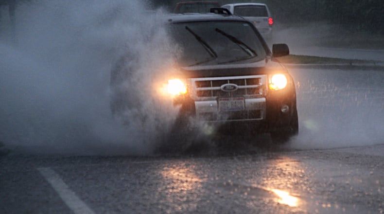
Daily commutes were made hazardous on Wednesday. Flood advisories were issued for Greene, Miami, Montgomery, Preble and Warren counties throughout the morning.
In Montgomery County, the number of vehicle accidents reported to the regional dispatch reached 25 by noon; this had already matched Sunday’s total, and was on pace to surpass Monday’s total of 29, as well as Tuesday’s rain-induced total of 48.
“We’ve had several injury crashes, and it’s hard to say from the dispatch standpoint what the calls were for, although a lot of it was probably weather-related,” Rob Streck, chief deputy for Montgomery County Sheriff’s Department, said on Wednesday afternoon. “As far as the calls go, we are up.”
Along with local deputies, towing companies were also kept busy by the weather Wednesday morning.
“Our tow truck drivers have been out all morning,” Joe Hobbins, lead estimator for Dayton-based Carl’s Body Shop and Towing, said. He predicted that his shop had seen a 25 percent increase in calls Wednesday morning, due to standing water and debris on the roads.
‘Hydroplaning’ common
On I-75 North, near the Moraine-West Carrollton border, Moraine police responded to a 9:36 a.m. call about a car sliding off the road and into the highway median, eventually crashing into a metal guardrail.
“They’re lucky that the guardrail was there, otherwise they would’ve ended up on the other side of the highway,” Moraine police Sgt. Mike Keegan said as he watched the green Subaru Legacy be towed away. “Looks like the all-wheel drive didn’t work today.”
Keegan said that the driver had hydroplaned, meaning that the excessive water on the roadway had filled the treads of the driver’s tires, causing them to lose grip on the road and the car to slide out of control.
Hydroplaning is common on days of excessive rainfall, Streck said, “especially the first half hour after a big storm comes through.”
“When you hit the puddle, or the large part of standing water, your wheels come off the ground, therefore your brakes won’t work at that point,” Streck said. “And then there’s also steering. So it’s almost like being on ice for that quick amount of time, which is plenty of time to hit another car, hit a wall, or slide off the road.”
Lightning abound
In a 15-minute span, between 6 and 7 a.m. Wednesday, there were up to 50 lightning strikes within a 20-mile radius of downtown Dayton, Collar said.
Multiple bolts were reported to have struck, and damaged, local properties, including one instance where a Springboro home was hit, causing a fire that damaged the roof and windows.
RELATED: Lightning strike may be to blame for Springboro fire
Another lightning strike was reported to have hit a barn in Jefferson Twp., causing it to burn to the ground.
“When I pulled up, and I was the first vehicle here, there wasn’t a bit of the barn that wasn’t involved (in flames),” Jefferson Twp. Fire Chief Larry Sexton told News Center 7. “I could see it for miles away.”
RELATED: Lightning strike possible cause of Jefferson Twp. barn fire
About the Author
