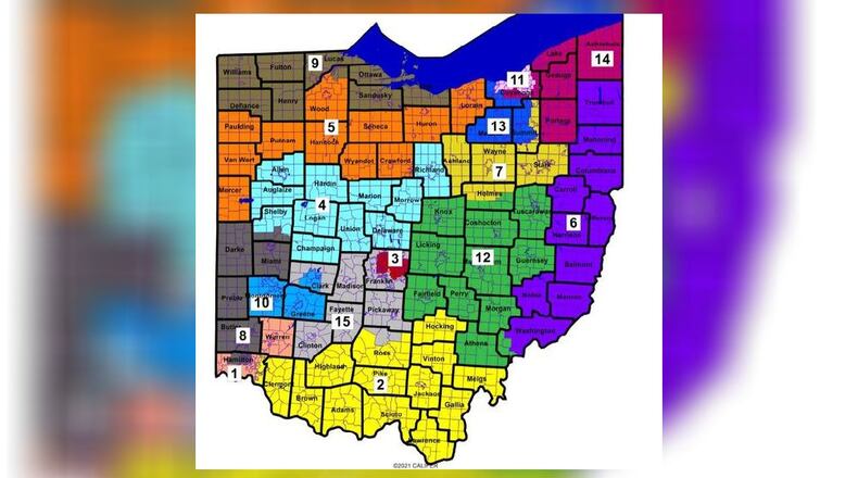
They said seven of the 15 districts on the proposed map would be “competitive” between Republicans and Democrats, based on previous voting trends.
Democrats say the map is more gerrymandering, as 13 of the 15 proposed districts lean Republican in a state that is more balanced than that politically.
The proposed map would keep Montgomery and Greene counties together in one district. Miami, Darke, Preble and Butler would again be grouped together, and Warren county would stay with part of Hamilton County, with some changes. Clark County would change, split between the Montgomery/Greene district and a more eastern district stretching into the Columbus area.
The state Senate could consider the map as soon as today, with the House to follow later in the week.
Every 10 years, Ohio lawmakers draw the lines for the state’s congressional districts. Ohio goes from 16 seats to 15 this time because Census data showed our state had less population growth than others.
