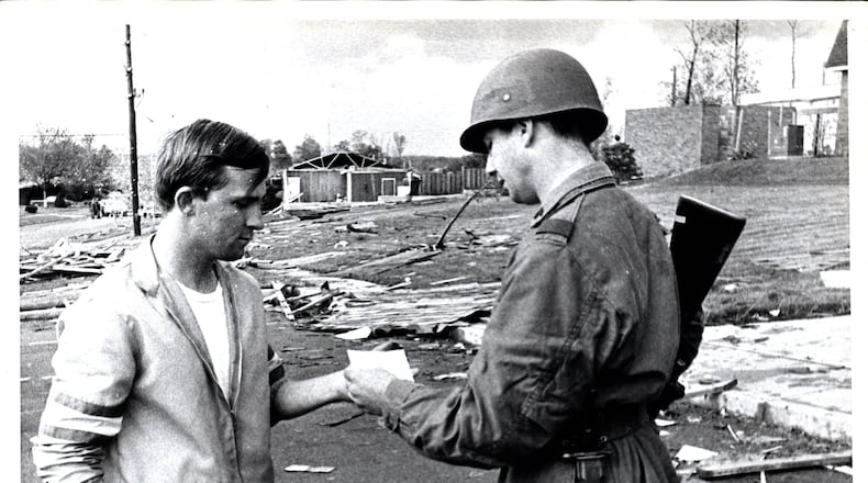
By comparison, the May 27 tornado destroyed 44 buildings among the 1,149 that were affected in just Beavercreek Twp., which includes the city.
The 1969 storm, which came five years before the notorious EF5 tornado that struck Xenia, displaced 300 people and the Red Cross set up a shelter with help from the Ohio National Guard at Fairmont East High School.
The estimated financial loss was a hotly debated topic, with city officials claiming losses in the millions of dollars and insurance adjusters estimating total losses of around $1 million. No federal aid was provided to assist in the recovery, because “80 percent of the damage is covered by insurance,” then Kettering Mayor Robert J. Haverstick was quoted.
Officials have not provided a monetary estimate of losses from the May 27 tornadoes, and it’s not yet known whether federal aid will be provided to help recovery efforts. Gov. Mike DeWine sent the request for federal aid on Tuesday.
The ‘69 twister formed suddenly when a cold front clashed with warm air to the west of Dayton, and there was little warning as “there was no line of thunderstorms connected with the movement of the cold front,” according to Chester Rathfon, then meteorologist in charge of the Dayton area’s U.S. Weather Bureau.
Storm Center 7’s Chief Meteorologist McCall Vrydaghs said she is researching the 1969 storm, but she believes what probably happened is it was “a very warm day before that cold front came.”
During the warmer months, warm air is layered above and below a layer of cold air called the “cap.” Vrydaghs said severe storms can be sparked when the cold air layer is warmed or is pushed into the warm air layers by a cold front.
“You can have a bright sunny day, then all of a sudden you have cumulus clouds and then all of a sudden you have these isolated strong storms.,” Vrydaghs said.
There’s a perception that more tornadoes are occurring in modern times when compared to the mid 20th century, but Vrydaghs said that may not be true.
“Back in the 1950s, ’60s, ’70s we didn’t have the same technologies, so tracking tornadoes back then, unless it was daylight and someone saw it, or perhaps we saw it on old radars, we may not have known if the damage was tornadic or straight line winds,” she said.
STAY CONNECTED: Greene County News on Facebook
Vrydaghs added that research shows there is a trend of more tornadoes occurring on fewer days.
“We’re seeing less days with tornadoes throughout the year, but on any given day when we do have a tornado, there seems to be more,” Vrydaghs said. “We have yet to find a direct link as to why there has been this shift, but there has been a shift.”
About the Author
