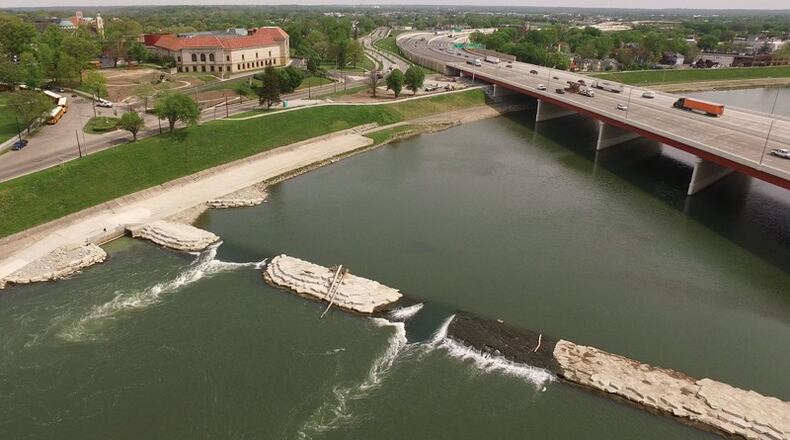
With that lofty goal in mind, Five Rivers MetroParks is working with the city of Dayton and the Miami Conservancy District to craft a 20-year master plan to be a far-reaching blueprint on how to make the riverfronts contribute to quality of life and economic development.
The partners are asking for the public’s help to develop a vision for the local waterways.
“I think this plan has the opportunity to transform our rivers from dividers in our community to uniters,” said Carrie Scarff, chief of planning and projects with Five Rivers MetroParks.
The $4 million RiverScape River Run opened in May, officially marking the completion of a comprehensive master plan for the downtown MetroPark.
RELATED: Why RiverScape River Run is a huge deal
Five Rivers MetroParks needs a new plan to deliberately and wisely guide riverfront growth and put the organization and Dayton in a good position to compete for and obtain federal funding, officials said.
The riverfront master plan will focus on 12 miles of river corridor that converge in the greater downtown area.
The waterways are the Mad River, Wolf Creek, the Stillwater River and the Great Miami River.
The plan will address the stretches of the rivers reaching north to Wegerzyn Gardens MetroPark, south to Carillon Historical Park, east to Eastwood MetroPark and west to Wesleyan MetroPark.
RELATED: More housing coming to Water Street District
The master plan will provide recommendations to enhance access to the rivers and their banks, as well as how they connect to the dozen or more adjacent public parks and 19 adjacent neighborhoods.
Other important institutions and destinations sit along the waterways that have a stake in their development, including the Dayton Art Institute, the Boonshoft Museum of Discovery, Carillon Historic Park, the University of Dayton and Sinclair Community College.
Downtown’s revival, driven in part by the success of the Water Street District along the Mad River, makes this an opportune time to map out how to better make the rivers regional destinations, said Scarff.
The plan will look at levees, public spaces, parks and private property along the river. The plan may make recommendations about areas that would be good for new transportation, recreation and fitness options and new restaurants.
Potential future improvements could be modeled after other communities and could better link the urban grid to the rivers, officials said.
Some cities have levee systems with steep steps down to the water, while others have hard edges that create overlooks along their river banks.
Playgrounds, skate parks and family recreation destinations could be complementary amenities, officials said. Other cities have piers or docks for fishing and observation.
The community should temper expectations, however, because there are stringent flood plain rules, said Dayton Mayor Nan Whaley.
“Look, we have a lot of ideas, but they don’t get to happen because of those rules,” she said.
The public is invited to an open house about the riverfront master plan at 11:30 a.m. or 5:30 p.m. Thursday. The events, which each will be about two hours, will be held in a community room at the main Dayton Metro Library at 215 E. Third St.
The plan is expected to be completed in June 2018.
About the Author

