Twenty-four GPS satellites (plus at least six spares) orbit twice a day at about 12,550 miles above the Earth, and at least four are “visible” to GPS receivers all the time over most of the Earth. As long as a minimum of four GPS satellites are “visible” above the horizon, cars, boats, ships, planes and people with GPS receivers, such as sports watches, cell phones or car navigation units, can pinpoint their positions.
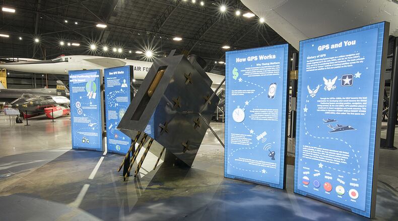
The new GPS exhibit, titled “Global Positioning System and its Impact!” occupies nearly 700 sq. ft. of floor space and takes the shape of a full-size current replica GPS satellite. Displayed on a large floor graphic of the Earth, the central satellite unit includes eight interpretive panels where the satellite’s solar panels would be.
Another display that was recently completed is titled “IUS-DSP Booster and Satellite: A Winning Combination.” The Inertial Upper Stage (IUS) and Defense Support Program (DSP) were two systems that rode into space together on a rocket such as the Titan IVB. Once in space, the IUS took over to boost the satellite even higher. IUS vehicles placed DSP satellites in “geosynchronous” orbits – stationary spots above the Earth – about 22,300 miles high.
The Inertial Upper Stage was an unpiloted upper-stage booster rocket developed for the U.S. Air Force that was used from 1982–2004. IUS vehicles were launched aboard rockets, such as the Titan IVB, and Space Shuttles, and once in space they lifted satellites into high orbits or sent probes on their way through space. Separating from the rocket about nine minutes after launch, the IUS would carry its satellite for six to seven hours and place it in a geosynchronous orbit about 22,300 miles above the Earth.
The Air Force employed DSP satellites in response to the growing threat from Soviet and Chinese nuclear ballistic missiles in the 1960s. These satellites were designed to detect missile launches and nuclear detonations by using infrared sensors to “see” heat from launches and explosions. After the Cold War, DSP satellites kept working, detecting Iraqi Scud missile launches during OPERATION DESERT STORM in 1991. Scientists have also used DSP infrared sensors for early warning of natural disasters such as volcanic eruptions and forest fires.
The DSP satellite on display is a full-sized (non-functional) structural test vehicle that was used to verify and test satellite configuration and came to the museum from Northrop Grumman in August 2010.
According to Dr. Doug Lantry, National Museum of the U.S, Air Force historian and curator, GPS and the IUS/DSP systems were both great examples of Air Force ingenuity.
“Satellite and orbital boost systems illustrate the Air Force’s reach and mission over the years,” said Lantry. “GPS has changed our everyday lives, DSP has kept our nation safe for decades, and IUS has enabled high-orbit satellite operations and deep-space probes that will inspire generations of explorers.”
In addition to the new exhibits, the Air Force Museum Theatre will feature the film "Space Junk 3D," narrated by Academy Award nominee Tom Wilkinson. The film is the first movie to explore the exponentially expanding ring of debris that threatens the safety of the planet's orbits. Harnessing the imagery of 3D Giant Screen, Full Dome and Digital Theater, Director Melissa Butts takes viewers soaring from the depths of Meteor Crater to an unprecedented view of the increasingly crowded orbits 22,000 miles above earth. The film will be shown at 1 p.m. and 4 p.m. daily. For additional information on the Air Force Museum Theatre, visit www.afmuseum.com/movietimes.
The National Museum of the U.S. Air Force, located at Wright-Patterson Air Force Base, is the world's largest military aviation museum. With free admission and parking, the museum features more than 350 aerospace vehicles and missiles and thousands of artifacts amid more than 19 acres of indoor exhibit space. Each year more than 800,000 visitors from around the world come to the museum. For more information, visit www.nationalmuseum.af.mil.
About the Author
