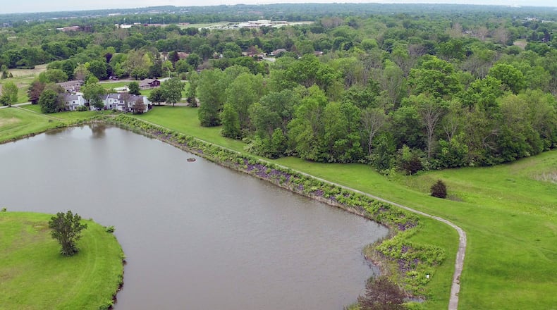
The rating, however, is not uncommon, according to Rodney Tornes, water division chief for ODNR. He said that the Class 1 rating happened when more residential development occurred downstream from the dam.
TRENDING: What we know now: Latest on federal investigation in Dayton
“Even though the dam is classified as a Class 1 High Hazard dam, it does not mean there is any immediate danger in that area,” Tornes said. “The dam is structurally sound.”
The state regulates 300 plus dams that are classified as Class 1 High Hazard, including five in the Miami Conservancy District.
If the dam were to fail, the water would flow downstream to the areas around streets that include Sherry Drive, Hillpoint Street, Elmore Street, Westland Drive, Belmore Trace, Tuscola Drive, Elysian Court, Shadows Glade Drive and Arundel Road.
ODNR approved the city’s emergency action plan (EAP) in July, but it went into effect this spring.
TRENDING: Dayton attorney represents group of former athletes in OSU sex abuse scandal
The 35-page EAP includes three notification levels: monitor, watch and warning:
Monitor — a hazardous condition exists, requires an investigation and corrective action. It can mean that a potential for failure has been assessed and corrective measures are underway.
Watch — the potential for a dam failure situation is developing.
Warning — the dam has failed or failure is imminent.
Each level has a series of city and state officials to contact when the levels are reached.
The Newfields dam is considered an earthen embankment dam, made of compacted earth. It was constructed in 1973.
The Class 1 High Hazard rating is based on the potential for loss of life and property damage downstream of the dam in an event of a dam failure, Tornes said. When a dam is classified as a Class 1 High Hazard, an emergency action plan is required by the Ohio Administrative Code.
The city spent about $38,740 on the EAP and engineering services related to the completion of the EAP and compliance with ODNR’s requirements.
The last state inspection was March 2016.
EMH&T Inc., based in Columbus, performed field measurements of the dam in 2017. The dam’s embankment spans about 800 feet, and the height is just less than 15 feet with normal pool elevation about 873.3 feet.
EMH&T is a group of engineers, surveyors, planners and scientists.
In general, EAPs can take six months to three-plus years to be written, funded and approved by ODNR. The dam has to be analyzed by an engineer to help with the EAP plan.
Residents with questions about the dam can contact Stephanie Kellum, Trotwood deputy city manager, at 937-854-7224, or Tornes at 614-265-6737.
About the Author
