Of all the days in February, there is one day that seems to stick out more than others when remembering past snows.
This Friday marks 13 years since the Valentine’s Day Winter Storm of 2007 that produced damaging ice and more than a foot of snow across parts of west-central Ohio.
It all started with an intense winter storm developing over the Southern Plains. Widespread rain moved into the region late on Monday, February 12, 2007. As the moisture encountered colder air located in northern Kentucky, southern Indiana, and Ohio early on Tuesday, the rain changed over to snow.
FORECAST: Wintry mix possible by midweek
The storm went through some intensification on Tuesday as it pulled warmer air in from the south. This caused the snow to quickly change to sleet and freezing rain Tuesday morning and afternoon across much of the I-70 corridor and points south.
Several inches of sleet accumulated on top of the snow, which later turned into freezing rain. Trees and power lines were coated with up to a quarter-inch of ice from Dayton to Columbus.
Farther south, closer to northern Cincinnati, the snow quickly changed to freezing rain Tuesday morning. The temperature never rose above freezing across these areas, which allowed ice to accumulate to between a half-inch and an inch. This resulted in significant tree damage and numerous power outages.
This strong storm was also accompanied by very strong winds with gusts up to 45 mph. This caused significant blowing and drifting of snow in the northern Miami Valley, from Troy to Marysville, and farther north into Celina, Wapakoneta, and Bellefontaine.
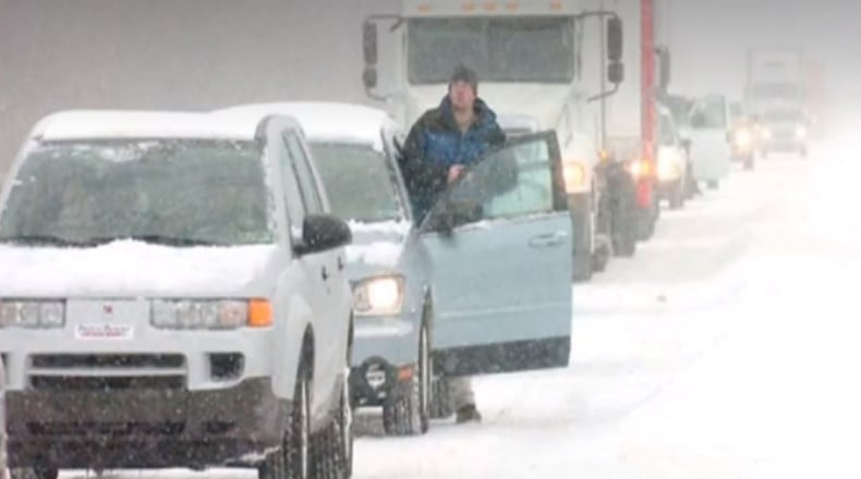
The continual blowing and drifting kept road crews busy and at times was difficult to keep roads clear. By Tuesday afternoon, travel across west-central Ohio was nearly impossible.
TRACK THE CONDITIONS | Live Doppler 7 Radar
As the sunset Tuesday evening roads became very dangerous. A Level 3 snow emergency had been declared in many counties in west-central Ohio. Snow continued to fall late Tuesday night, and by Wednesday morning had accumulated from 8 to 15 inches.
The wind caused snow to drift substantially. In some cases, drifts were more than 4 feet high.
As for this Valentine’s Day — Snow may not be in the forecast, but the cold air will. Right now, temperatures are expected to range in the teens and 20s.
Stay tuned to WHIO and the Storm Center 7 team for updates throughout the week.
About the Author
