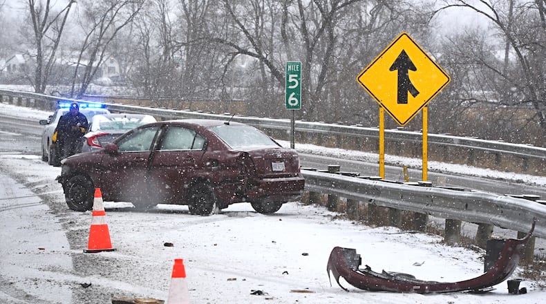
A mixture of sleet kept the snowfall totals well below the top end amount predicted, but it did set a record for Feb. 15 at the Dayton International Airport.
Credit:
Credit:
“If you don’t have to go out — don’t,” AAA – Miami Valley’s Kara Hitchens said.
Said Dayton Power & Light’s Mary Ann Kabel, “Right now, people just to have to put safety first.”
Sinclair Community College canceled all on-campus classes and Premier Health canceled a COVID-19 vaccine clinic Monday as the National Weather Service issued winter storm warning from Texas to Maine, including most of Ohio, where it expired at 1 p.m. Tuesday.
Dayton Children’s Hospital Monday afternoon canceled outpatient appointments, which will reopen Tuesday afternoon depending on the weather.
Until the warning is lifted, “travel could be very difficult to impossible,” according to the weather service in Wilmington, which recorded a wind chill of 7 degrees Monday afternoon in Dayton. “The hazardous conditions could impact the morning or evening commute.”
Beavercreek, Dayton, Fairborn, Kettering and Xenia were part of an area expected to get 5 to 7 inches of snow with a storm total of 6 to 9 inches, the NWS said.
Tuesday’s high is expected to be 20 with a low of 1 degree while Friday’s low is forecast at minus 2, according to Accuweather.
Tuesday afternoon and much of Wednesday is expected to see a reprieve from snow, but Wednesday afternoon and night may see “another potential snow event coming that lasts through Thursday,” said Matt Campbell, a NWS meteorologist in Wilmington.
While the weather service wasn’t making specific predictions for later in the week, Campbell said Monday the region could see “definitely another impact snowfall possible Wednesday night into Thursday.”
Residents are encouraged to have storm kits prepared should power outages occur, said Kabel, DP&L’s director of corporate communications. They should include flashlights, non-electric mobile phone charging devices, batteries, cash, blankets, medications and emergency numbers, she said.
In the event of a power outage, DP&L customers should call 1-877-4OU-TAGE or contact dpandl.com/outage.
“We can’t tell if a person’s (power) is out,” Kabel said. “And just because your neighbor may be out doesn’t mean that they’re calling your outage in, too. So — especially in these conditions — we encourage people who do experience an outage to tell us right away.”
For those who have to drive, be sure to “completely clear” the snow and ice from your vehicle, according to AAA’s Hitchens.
“You want to be able to see clearly through the windshield and windows,” she said. “And you want to prevent blowing snow and ice on the vehicle behind you.”
Credit:
Credit:
Motorists also are encouraged to check their automobile batteries and tire pressure. Auto accidents led to two weekend power outages as vehicles hit poles Saturday and Sunday, causing outages to about 2,500 DP&L customers combined, Kabel said.
The Ohio Department of Transportation discourages traveling Tuesday and anyone who must travel should bring a fully charged cellphone, a flashlight, food, water and blankets in case of an emergency, the NWS said.
ODOT will have crews working 12-hour shifts to treat and clear the roads, ODOT District 7′s Mandi Dillon said.
Going forward this week, “they will continue to work in shifts around the clock until roads are clear,” Dillon said in an email.
“They will be using a higher concentration of calcium chloride and agricultural deicer so that their material is more effective in the extreme cold temperatures,” she added.
SNOW HISTORY
The following are the top 10 snowfalls in inches at Dayton International Airport since 1948:
DATE SNOW
Jan. 26, 1978 12.2
Dec. 22, 2004 11.5
March 22, 1968 11.2
March 8, 2008 10.3
Jan. 1, 1964 9.8
March 1, 1963 9.1
Jan. 7, 1979 8.4
Jan. 2., 1996 8.4
Nov. 25, 1950 8
March 30, 1987 7.9
Source: Dayton International Airport
About the Author


