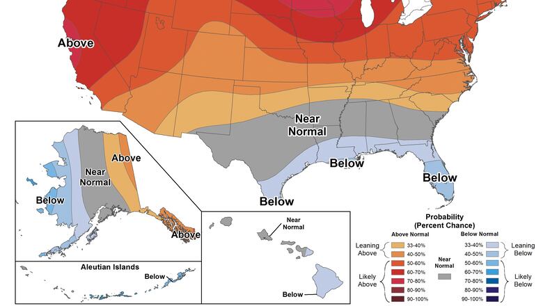
Monthly temperatures in southwest Ohio have been above the mean for all but two months, with June down 1.8 degrees and September a near tie, data show.
After a high expected in the mid-50s for today — 15 to 20 degrees above normal — the high temperature for the next few days will drop into the 40s and mid-30s, but still will be above normal, the NWS said.
The European Union’s Copernicus Climate Change Service announced early this month that 2023 officially became the hottest year ever recorded after analyzing data that showed the world’s warmest ever November.
“2023 has now had six record-breaking months and two record-breaking seasons,” Samantha Burgess, deputy director of the Climate Change Service, said following the release of its report. “The extraordinary global November temperatures, including two days warmer than 2 degrees Celsius (3.6 degrees Fahrenheit) above preindustrial, mean that 2023 is the warmest year in recorded history.”
Scientists say the year has been so hot partly because oceans are warming and are doing less to counteract excess heat than in the past.
Also, the climate pattern El Niño has led to record warmth. Nearing its peak, it could be one of the strongest over the past 75 years, according to the National Oceanic and Atmospheric Administration’s Climate Prediction Center, a division of the NWS, which said in a Dec. 14 update that it has a 54% chance of being in the top five since 1950.
This year, El Niño was in place heading into winter for the first time in four years, which is driving the outlook for above average temperatures and below average precipitation in states including Ohio.
El Niño and La Niña are climate patterns in the Pacific Ocean that can affect weather worldwide. After three consecutive years of La Niña, El Niño started in June. It generally lasts nine to 12 months and tends to occur every two to seven years on average, but it doesn’t have a regular schedule.
During El Niño, trade winds weaken and warm water is pushed east, toward the west coast of the Americas. With this shift, areas in the northern U.S. and Canada are dryer and warmer than usual, according to NOAA.
Climate models indicate El Niño conditions could wane between April and June, according to an analysis from the Climate Prediction Center.
However, El Niño often is followed in the fall by La Niña, particularly if the El Niño is strong. The most recent strong El Niños were in 1998 and 2016, which recorded the world’s hottest year up to that time. Both were followed by La Niña. Opposite of El Niño, during La Niña winter temperatures are cooler in the north, NOAA reported.
About the Author

