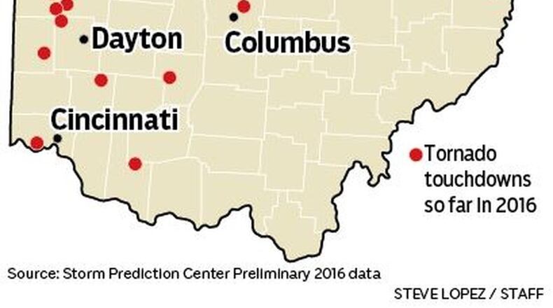
So why have we seen an uptick in the amount of severe weather lately? It turns out that extreme humidity is likely one key reason. After a dry middle of summer, a large area of high pressure has managed to set up off the East Coast near Bermuda. The clock-wise flow around this system has been able to pull up incredible amounts of moisture from the Atlantic and Gulf of Mexico into the Ohio Valley. This moisture is in the form of high humidity which helps fuel strong to severe storms.
Last week, the amount of moisture in the air that can be used to generate rainfall, call precipital water, was over 200% higher than normal. This moisture combined with energy from decaying storms over the central Plains to produce a rare August tornado outbreak for Indiana and Ohio. The weather environment over the eastern United States has been so unusual that numerical forecast models meteorologists use to aid in forecasting have had a difficult time locking on to when strong storms will develop more than beyond about 12 hours out. And while the environment that led to last week’s outbreak turned out to be very unstable, almost all forecast models were not able to simulate tornadic supercells until about the time the first tornado warnings were being issued in Indiana.
Now you’ve likely seen some of the astonishing pictures of the damage, including a totally destroyed Starbucks in Kokomo, Ind. What is even more astonishing than the tornado outbreak itself was the fact that no one was seriously injured or even killed. This, after 31 tornadoes, including several rated at EF-2 or higher, ravaged Indiana and northwest Ohio. The National Weather Service credits emergency personnel, trained storm spotters and the media for the ability to provide over around 15 minutes or more of warning time before each tornado.
The weather pattern does look to change to a more fall-like pattern as we start September. This should lead to more tranquil weather later this week into the coming weekend. However, it is typical for Ohio to see a “mini-severe weather season” in late October into early November, so we may not be done adding to this year’s tornado count just yet.
Eric Elwell is WHIO StormCenter 7 Chief Meteorologist. Contact him at eric.elwell@coxinc.com or follow him on Facebook and Twitter.
About the Author
